
Improving water security for the poor
REACH Data Archive
The REACH programme has created an archive of over 30 datasets generated by the research which took place across its various observatories and grants. These include:
- 14 water quality datasets from studies of urban rivers in Dhaka (Bangladesh); drinking water sources in Khulna and Matlab (Bangladesh) and Western Nepal; a major aquifer serving Turkana County (Kenya); and surface and groundwater sources in the Awash River Basin (Ethiopia) including information on organic contaminants of emerging concern in the upper Awash basin and piped water sources in Addis Ababa
- 6 extensive household survey datasets relating to household WASH in Dhaka and Khulna (Bangladesh), Turkana and Kilifi counties (Kenya) and Wukro town (Ethiopia)
- Water service infrastructure audits in Khulna (Bangladesh) and Kitui County (Kenya) including an audit of water services in the county’s 1,887 primary and secondary schools
- Geological and isotope studies to characterize aquifer systems in the upper Awash Basin (Ethiopia) and the Lodwar Alluvial Aquifer System, Turkana County (Kenya)
- Focus group discussions on local perceptions of water-related hazards and water management institutions in Khulna (Bangladesh)
- Observations of river use by city dwellers in Dhaka and Gazipur districts (Bangladesh)
- Data on sedimentation and flow velocity from coastal rivers in southwest Bangladesh
- Soil moisture level data from experimental and control catchments to assess the effect of sustainable land management techniques in the Blue Nile Highlands (Ethiopia)
- Data on macroinvertebrate diversity and abundance collected through a study of the application of macroinvertebrate indices for water quality monitoring in the Upper Awash Basin (Ethiopia)
- Sanitary inspections from piped water supplies in Western Nepal
- Data from a study on the prevalence and abundance of antibiotic-resistant Escherichia coli (AR-Ec) among people and drinking water in high and low arsenic-contaminated areas in Bangladesh.
Each dataset in the list below has a link through which you can access and download the data, along with further details and links to related publications.
Water security for an urban river
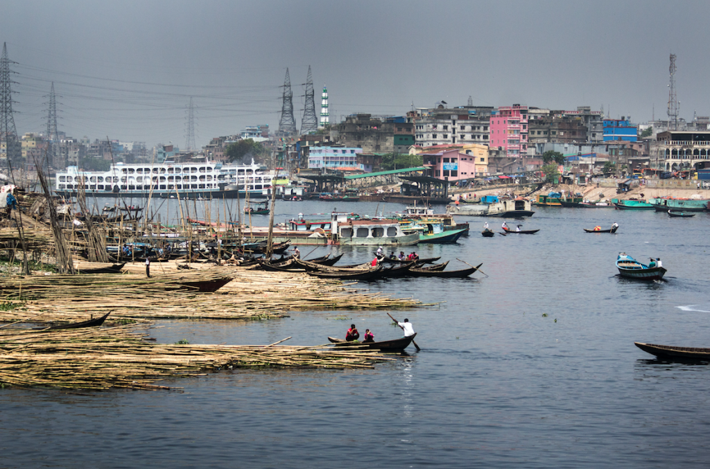
Water quality in the Dhaka River system, Bangladesh, January 2017 to July 2021
This dataset comprises periodical analysis of various water quality parameters including organics, inorganics and microbial concentrations from 58 sampling points over five years (2017-2021) in rivers and canals in the Greater Dhaka watershed, Bangladesh.
Creators: Hossain, M.A., Shawal, S.
REACH Dhaka WASH Household Survey, 2017-2018
The REACH Dhaka WASH Household Survey was conducted between December 2017 and February 2018 to collect quantitative data on various indicators of multidimensional poverty, the state of drinking water services and sanitation facilities, household expenditures, illnesses in the past year and priority concerns for development. The survey was carried out along a 25km stretch of river (Turag and Tongi-Khal) in northern Dhaka covering low-income settlements within 1km of the riverbank.
Creators: Hoque, S., Khaleque, M.A.
Daily River use observations in Dhaka, Bangladesh
Structured observations of daily river water use practices, disaggregated by gender and age, were conducted along a 25km stretch of the Turag River and Tongi Khal during the dry (Feb 9–26, 2019) and wet (Aug 20–Sept 3, 2019) seasons on the borders of Dhaka and Gazipur districts in Bangladesh.
Creator: Hoque, S.
Coastal Water Security
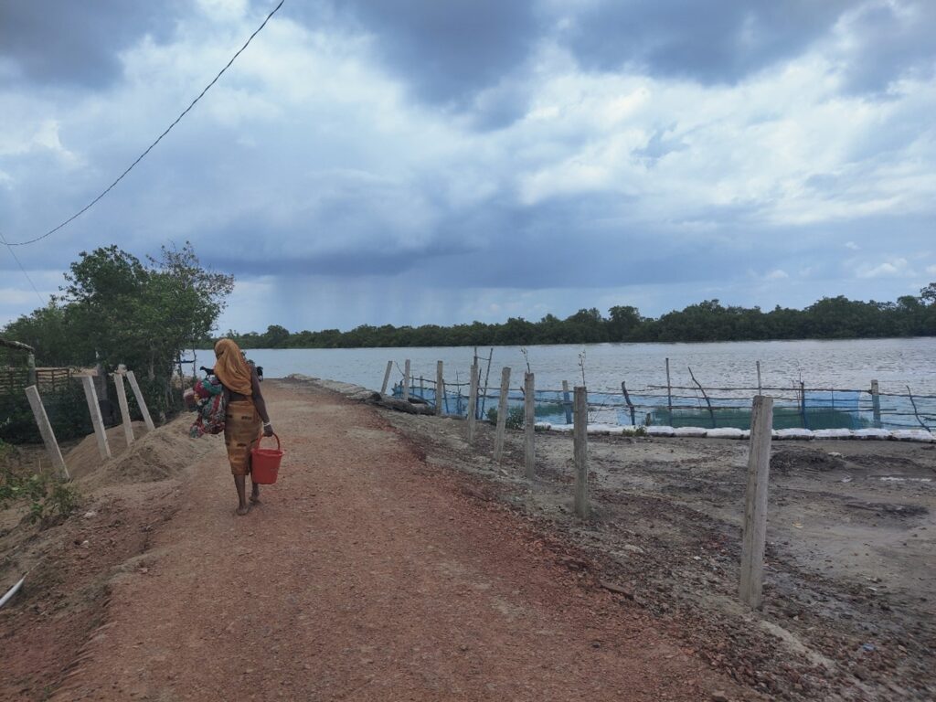
Sedimentation, flow velocity and discharge data from coastal rivers in Southwest Bangladesh
The REACH programme investigates sedimentation and waterlogging in Coastal Bangladesh—critical issues identified in the Delta Plan 2100 impacting 1.3 million people—through hydrodynamic and sediment transport research in the Hari-Ghengrail-Sibsa river system, providing valuable data and insights for sustainable water management solutions.
Creators: Uddin, M S., Salenhin, M.
Weather station data from Khulna division (Polder 29), Bangladesh 2018-2023
Weather station data collected under REACH programme at locations in Khulna division, Bangladesh includes temperature, humidity, dew point, windspeed and direction, rainfall, pressure, weather status.
Creator: Salehin, M.
REACH Khulna Seasonal Water Quality Analysis (2020-21)
Water samples (n=131) were taken from 115 waterpoints in Polder 29 of Khulna district (Bangladesh) and tested at the Laboratory Environmental Health at the International Centre for Diarrhoeal Diseases (icddr,b) to understand seasonal variations in water quality across different water supply technologies.
Creators: Charles, K., Mahmud, Z H., Hoque, S.
Focus group discussions and key informant interviews exploring local perception of water/climate-related hazards in Khulna, Bangladesh
Focus group discussions and key informant interviews in Khulna, Bangladesh (January 2019) explored local perceptions of water- and climate-related hazards, including riverbank erosion, waterlogging, storm surge flooding, and salinity.
Creators: Rahman, MM., Hasan, MH., Hossain, MJ.
DOI: 10.5287/ora-bpad6nkjy
Focus Group Discussion on perceptions of water institutions relating to water management in Khulna Bangladesh
Record of a focus group discussion conducted in January 2019 with water institution representatives in Khulna, Bangladesh.
Creators: Rahman, MM., Hasan, MH., Hossain, MJ.
REACH Khulna Household Survey, 2018
The REACH Khulna Household Survey was conducted between December 2017 and February 2018 to collect quantitative data on various indicators of multidimensional poverty, the state of drinking water services and vulnerability to water-related hazards.
Creators: Hoque, S., Hope, R., Salehin, M.
DOI: 10.5255/UKDA-SN-854685
REACH Khulna Tubewell Audit, 2018
The REACH Khulna Tubewell Audit mapped 3,159 public and private tubewells (or handpumps) in Polder 29, a coastal area in Khulna, Bangladesh, collecting data on location, specifications, ownership, usage, and salinity levels over two phases between December 2017 and May 2018.
Creators: Salehin, M., Hoque, S., Hope, R.
DOI: 10.5255/UKDA-SN-854688
Universal Drinking Water Security
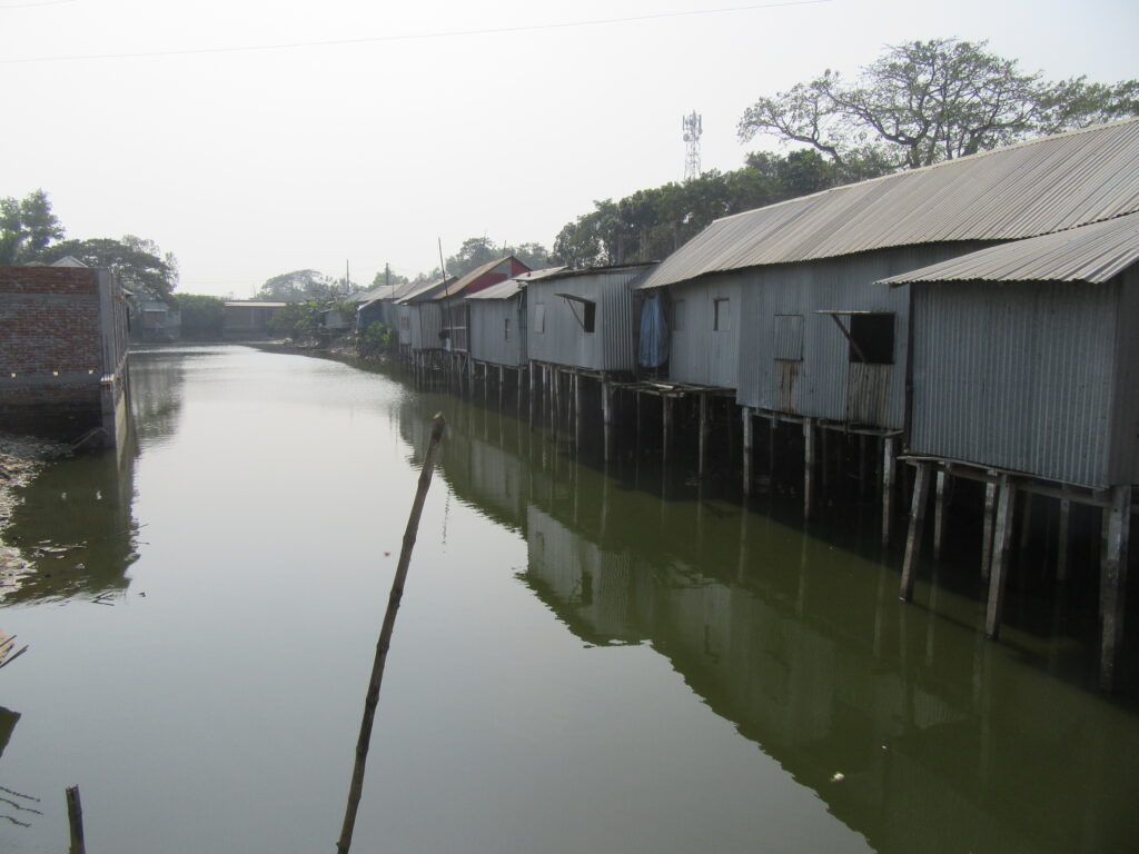
Matlab TLF pilot study results
Results from a pilot round of sampling for temperature, pH, conductivity, E.coli, dissolved organic carbon and fluorescence (tryptophan-like, coloured dissolved organic matter, and excitation emission matrix) of water from handpumps at schools and households in the Matlab area (6th July to 10th July 2018).
Creators: Nowicki, S., Deep, J., Ali, S., Saha, G C.
Building Water Secure Institutions
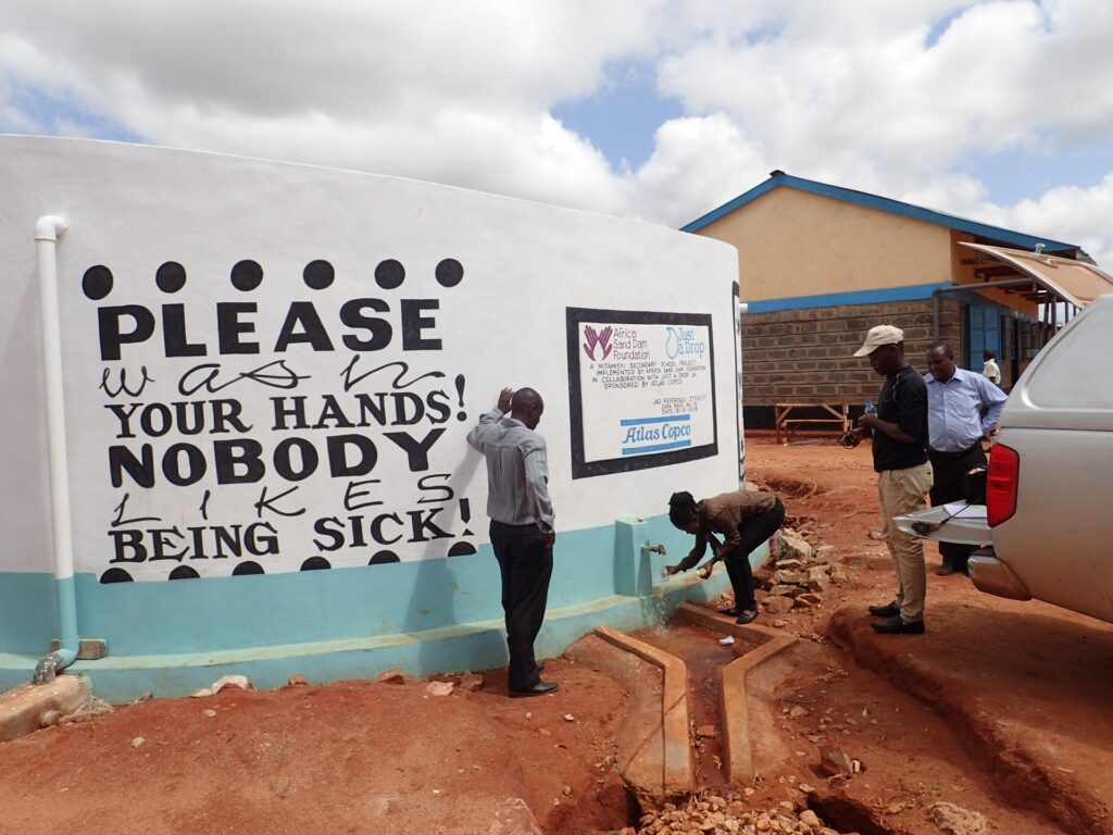
Water, sanitation and hygiene facilities assessment in Kitui county schools 2019
This dataset captures a comprehensive audit of Water, Sanitation, and Hygiene (WASH) services and management in 1,887 primary and secondary schools in Kitui County, Kenya, conducted by 26 trained enumerators, with head or deputy teachers as primary respondents.
Creators: Hope, R., Katuva, J., Nyaga, C. and Koehler, J.
Kitui County Water Infrastructure Audit, 2011-2018
The University of Oxford developed a water audit instrument with Kitui County Government and piloted it in Mwingi North Sub-County in 2016, building on a smaller dataset on handpumps which was collected in 2011. The survey was extended to waterpoints in Kitui’s remaining seven sub-counties with data collection in November to December 2017.
Creators: Nyaga, C., Katuva, J., Hope, R., and Koehler, J.
Small towns in fragile environments
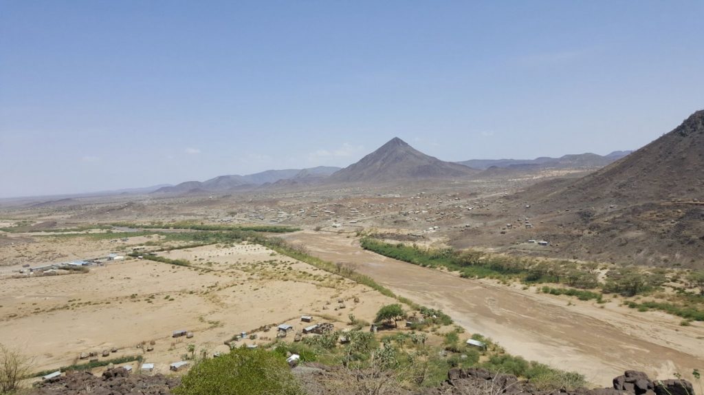
REACH Turkana WASH Household Survey, 2017
The REACH Turkana WASH Household Survey was conducted in October 2017 to collect quantitative data on various indicators of multidimensional poverty, the state of drinking water services and sanitation facilities, and priority concerns for development. The survey was carried out in Lodwar town and its peripheral areas in Turkana Central subcounty of Turkana county in northwest Kenya.
Creators: Opondo, M., Ong’ech, D., Hoque, S.
Isotope analysis of groundwater, surface water and rain in Lodwar and its environs, Turkana County, Kenya
This study aimed to analyze water sources within the Turkwel River basin in Turkana County, focusing on isotope analysis of groundwater, surface water, and rain. The isotope study represented the first comprehensive effort to understand water sources in northwestern Kenya.
Creators: Tanui, F., Olago, D., Ouma, G., & Kuria, Z.
Vertical Electrical Soundings from the Lodwar Alluvial Aquifer System, Turkana County, Kenya
A total of 27 vertical electrical soundings (VES) were conducted within the Lodwar Alluvial Aquifer System (LAAS) to investigate subsurface geology and estimate the depth of aquifer units in February 2019. The Schlumberger configuration was employed, where current was passed through two electrodes (A and B) while measuring the potential difference between electrodes (M and N).
Creators: Tanui, F., Olago, D., Ouma, G., & Kuria, Z.
Trace and major element analysis for rock samples from Lodwar and its environs, Turkana County, Kenya
53 of 69 rock samples collected in the Lodwar region (Turkana County, Kenya) in February to June 2018 were processed and analysed to assess their chemical composition.
Creators: Tanui, F., Olago, D., Ouma, G., & Kuria, Z.
Thin section photomicrographs of rock samples from Lodwar and its environs, Turkana County, Kenya
Ten of 69 rock samples collected during a comprehensive geological mapping exercise in Lodwar (Turkana County, Kenya) conducted in February and May 2018 were petrographically analyzed. Thin sections were prepared at the Department of Mines and Geology laboratory using standard mounting techniques.
Creators: Tanui, F., Olago, D., Ouma, G., & Kuria, Z.
Groundwater and surface water quality in Lodwar and its environs, Turkana, Kenya
This dataset records the chemical composition and quality of groundwater and surface water samples collected in Lodwar and its environs, Turkana County, Kenya during one dry season (February 2019) and one wet season (May 2018).
Creators: Tanui, F., Olago, D., Ouma, G., & Kuria, Z.
Sustaining growth through water security
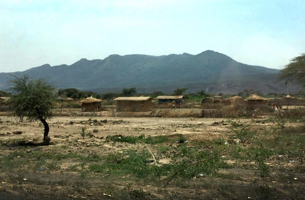
Credit: Katrina Charles/REACH
Groundwater quality data from the Awash Basin (physicochemical parameters and heavy metals)
To investigate heavy metal pollution and nutrient loads in the Awash river basin, Ethiopia, water samples were collected from various groundwater sources over one year (April, June, August, end of October 2021).
Creators: Abebe, Y., Whitehead, P., Alamirew, T., Jin, L., & Alemayehu, E.
Surface water quality data from the Awash Basin, Ethiopia
To investigate heavy metal pollution and nutrient loads in the Awash river basin, Ethiopia, surface water samples were collected from various locations over one year (April, June, August, end of October 2021).
Creators: Abebe, Y., Whitehead, P., Jin, L., Alamirew, T., & Esayas, A.
Physicochemical characterization and applicability of the Mini Stream Assessment Scoring System (MiniSASS) and the South African Scoring System (SASS) Version 5 in the Upper Awash Basin, Ethiopia
This data was collected to test the applicability of biomonitoring tools, SASS5 and miniSASS, in intermittent rivers in the Upper Awash River in Ethiopia. The data consists of lists of aquatic macroinvertebrates in samples taken from selected sites on the river alongside concurrent physicochemical monitoring and heavy metal and other metal concentrations.
Creator: Jele, Z. Y.
Isotope and water chemistry data from tapwater and its sources in Addis Ababa, Ethiopia
This data was collected as part of a study into the use of environmental tracers (Water isotopes-δ18O–δ2H, Radon-222Rn, and Electrical Conductivity-EC) as tools for backtracking to the water source, estimating pipe water residence time, and monitoring the instability of the water quality in piped water supplies in Addis Ababa, Ethiopia.
Creators: Kebede, S., Hailu, K., Siraj, A., & Birhanu, B.
Soil chemistry measurements from the Awash River Basin, Ethiopia in 2022
Soil chemical parameters including soil pH, EC, exchangeable cations and anions, exchangeable sodium percentage (ESP), and heavy metal concentrations were determined using appropriate procedures and methods.
Creators: Kebede, E., & Zinabu, E.
Organic contaminants of emerging concern in the Awash River basin
Emerging Organic Contaminants (EOCs) affecting freshwater quality have become a rising concern due to adverse effects on human health and the environment. In this research, we characterized EOCs in the water supply sources (boreholes, surface water reservoirs, and river) and tap waters in upper Awash River sub-basin, Ethiopia.
Creators: Hailu, K., Birhanu, B., & Kebede, S.
Surface water quality in high and low flow seasons in the Middle Awash River, Ethiopia, 2022
In a study to investigate temporal and spatial dynamics of irrigation water quality in the Middle Awash River, samples were taken at 10 sites along the river.
Creators: Kebede, E., & Zinabu, E.
Regional groundwater flow system characterization of volcanic aquifers in upper Awash using multiple approaches, central Ethiopia
Characterization of the groundwater flow systems is important for sustainable water resource management decision-making. The dataset comprises of vertical profiles of electrical conductivity (EC) and water temperature taken at 2 m intervals during drilling of 109 boreholes, and samples for stable isotope analysis (δ18O, δ2H) taken from 47 boreholes to characterize groundwater recharge, flow and discharge in the Upper Awash sub-basin.
Creators: Hailu, K., Birhanu, B., Azagegn, T., & Kebede, S.
Water service interruption frequency for 30 households in Addis Ababa, Ethiopia
A snapshot survey of dry (May 2020) and wet (August 2020) seasons of water interruption in six selected Addis Ababa sub-cities and for different water sources (groundwater/reservoir). Data collected by households in each area.
Creators: Birhanu, B., Kebede, S., Alamirew, T., Zeleke, G., & Charles, K.
Water security in fragile environments
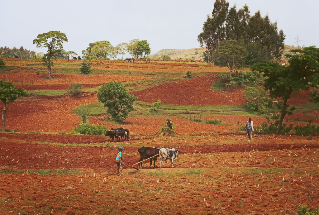
Soil moisture levels in experimental and control catchments to assess the effect of sustainable land management techniques in the Blue Nile Highlands
This data set comprises of daily readings (May to September 2018) from 2 study and 2 control catchments of volumetric soil moisture content (θ), which were taken at two measurement points and 4 monitoring depths per experimental site compared to a reference baseline soil moisture level recorded at the start of the wet season (θ^0), and cumulative rainfall in the study area.
Creators: Mersha, B. D., Zeleke, G., Alamirew, T., Dejen, Z. A., & Gebrehiwot, S. G.
Small town pathways to water security
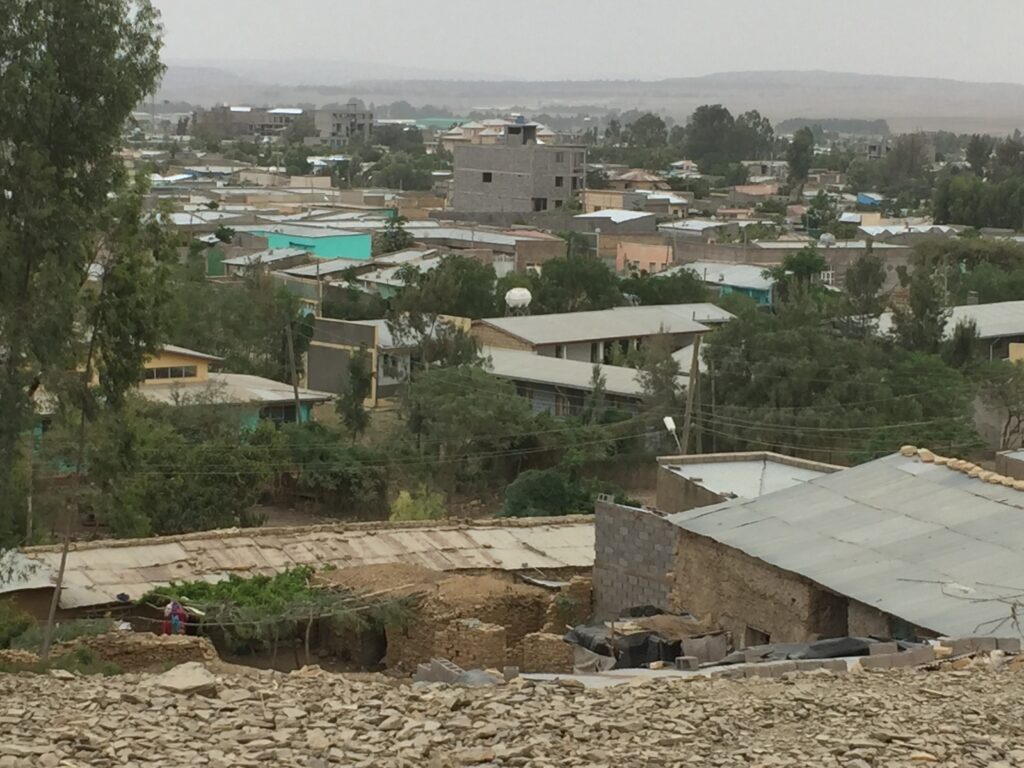
Wukro WASH Household Survey, 2019
Wukro is a small town of 43,000 people located in the drought-prone highlands of Tigray region, Ethiopia. This data comprises a survey of 701 households in Wukro town conducted in August 2019. This was designed to capture information about perceptions of priority development challenges in the town and detailed information about barriers to water access at the household level.
Creator: Grasham, C.
REACH Catalyst grant: Establishing a water quality monitoring network in mid-western Nepal
REACH Nepal Catalyst – Combined sanitary inspection data
Non-randomized pre/post evaluation of 5 piped water supplies in Dailekh district, Surkhet, Western Nepal. This data file contains the sanitary inspection data collected from 8 piped water systems based on direct observations of the infrastructure. The work was conducted with support from a REACH programme catalyst grant to these organizations: Eawag, Helvetas-Nepal.
Creators: Marks, S., Tosi Robinson, D., Kunwar, B. M., & Bhatta, M.
REACH-Nepal Catalyst – baseline to endline household-level water quality data
Non-randomized pre/post evaluation of 5 piped water supplies in Western Nepal. This data file contains the water quality data collected from 120 households based on conducting a household survey and sampling of household storage containers.
Creators: Robinson, D. T., Schertenleib, A., Kunwar, B. M., Bhatta, M., & Marks, S. J.
REACH Nepal Catalyst grant – Baseline to endline scheme level water quality data from 8 piped water systems in Western Nepal
Non-randomized pre/post evaluation of 5 piped water supplies in Dailekh district, Surkhet, Western Nepal. This data file contains the water quality data collected from 8 piped water systems based on sampling tanks and collection taps between June 2017 and January 2018.
Creators: Marks, S., Tosi Robinson, D., Kunwar, B. M., & Bhatta, M.
REACH Catalyst grant: Co-occurrence of heavy metal and antibiotic resistance in microorganisms due to arsenic contamination in water insecure areas of Bangladesh
Antibiotic-resistant Escherichia coli and arsenic exposure among people and drinking water in Hajiganj and Matlab, Bangladesh
Drinking water and stool from mothers and their children (<1 year) were collected from 50 households per area. AR-Ec was detected via selective culture plating and isolates were tested for antibiotic resistance, arsenic resistance, and diarrheagenic genes by PCR. Whole-genome sequencing (WGS) analysis was done for 30 E. coli isolates from 10 households.
Creators: Amin, M.B., Talukdar, P.K., Asaduzzaman, M. et al.
DOI: 10.1371/journal.ppat.1010952.s004
REACH WISER: Water Insecurity, Equity and Resilience and related studies
Water Portfolio Household Survey Round 2, Kilifi County, Kenya, 2023
This dataset, collected under the REACH and MAGNET programmes, captures household and individual-level data on water use, gender dynamics, and decision-making in rural Kaloleni, Magarini, and Ganze sub-counties of Kilifi County, Kenya, with a focus on women’s agency in asset control and decision-making.
Creators: Hillesland, M. & Doss, C.
Water Portfolio Household Survey, Round 1, Kilifi County, Kenya, 2022
The survey conducted in the rural sub-counties of Kaloleni, Magarini, and Ganze in Kilifi County, Kenya, examined household water use, rainfed agriculture practices, and women’s agency through comprehensive household and individual questionnaires addressing decision-making, asset control, and daily living dynamics.
Creators: Hillesland, M. & Doss, C.
